


Benton Voting District, Cedar County, Missouri
About
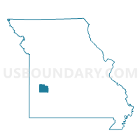
Outline

Summary
| Unique Area Identifier | 607457 |
| Name | Benton Voting District |
| County | Cedar County |
| State | Missouri |
| Area (square miles) | 84.32 |
| Land Area (square miles) | 84.13 |
| Water Area (square miles) | 0.19 |
| % of Land Area | 99.77 |
| % of Water Area | 0.23 |
| Latitude of the Internal Point | 37.67081840 |
| Longtitude of the Internal Point | -94.00619980 |
Maps


Graphs
Select a template below for downloading or customizing gragh for Benton Voting District, Cedar County, Missouri


Neighbors
Neighoring Voting District (by Name) Neighboring Voting District on the Map
- Box No. 2 Voting District, Cedar County, MO
- Cedar & Ernest Voting District, Dade County, MO
- Milford Voting District, Barton County, MO
- North & North Sac Voting District, Dade County, MO
- North Linn Voting District, Cedar County, MO
- Sheldon Community Building Voting District, Vernon County, MO
- South Linn Voting District, Cedar County, MO
Top 10 Neighboring County Subdivision (by Population) Neighboring County Subdivision on the Map
- Box township, Cedar County, MO (5,814)
- Linn township, Cedar County, MO (3,880)
- Benton township, Cedar County, MO (1,087)
- Montevallo township, Vernon County, MO (318)
- North township, Dade County, MO (307)
- Cedar township, Dade County, MO (304)
- Milford township, Barton County, MO (272)
Top 10 Neighboring Place (by Population) Neighboring Place on the Map
Top 10 Neighboring Unified School District (by Population) Neighboring Unified School District on the Map
- El Dorado Springs R-II School District, MO (8,193)
- Stockton R-I School District, MO (6,931)
- Greenfield R-IV School District, MO (3,250)
- Lockwood R-I School District, MO (2,303)
- Golden City School District, MO (1,688)
- Sheldon R-VIII School District, MO (1,154)
Top 10 Neighboring State Legislative District Lower Chamber (by Population) Neighboring State Legislative District Lower Chamber on the Map
- State House District 133, MO (37,830)
- State House District 126, MO (36,895)
- State House District 125, MO (35,564)
Top 10 Neighboring State Legislative District Upper Chamber (by Population) Neighboring State Legislative District Upper Chamber on the Map
- State Senate District 31, MO (190,281)
- State Senate District 32, MO (183,401)
- State Senate District 28, MO (177,259)
Top 10 Neighboring 111th Congressional District (by Population) Neighboring 111th Congressional District on the Map
Top 10 Neighboring Census Tract (by Population) Neighboring Census Tract on the Map
- Census Tract 8701, Cedar County, MO (5,661)
- Census Tract 8703, Cedar County, MO (3,319)
- Census Tract 4802, Dade County, MO (3,147)
- Census Tract 9506, Vernon County, MO (3,092)
- Census Tract 9601, Barton County, MO (2,986)
Top 10 Neighboring 5-Digit ZIP Code Tabulation Area (by Population) Neighboring 5-Digit ZIP Code Tabulation Area on the Map
- 64759, MO (8,244)
- 64744, MO (7,836)
- 65785, MO (5,259)
- 65682, MO (1,980)
- 64784, MO (1,500)
- 64756, MO (742)